🗃
Bring Your GIS Files
Open shapefiles, GeoPackage, KML, GeoJSON, and CSV data from Files, iCloud Drive, email, or shared storage. Stack layers, style them, label them, and inspect attributes on-site.
🔄
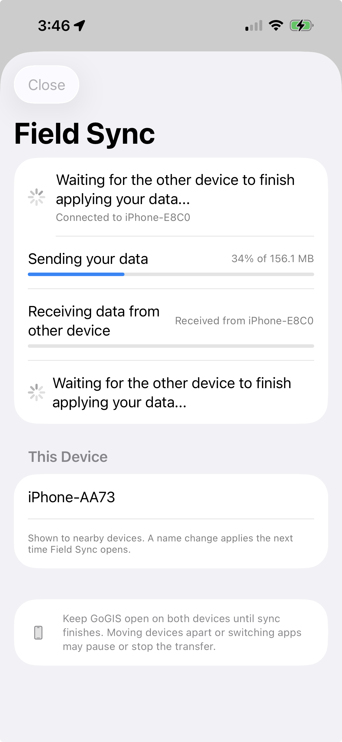
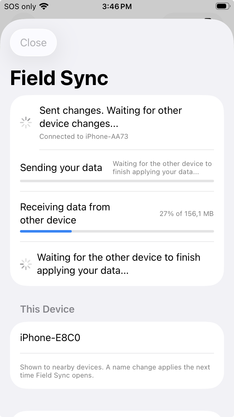
Sync Nearby Devices
Field Sync exchanges per-record changes directly between devices. It is ideal for one-person iPhone/iPad workflows, two-person crews, and disconnected jobs where simple local sync matters.
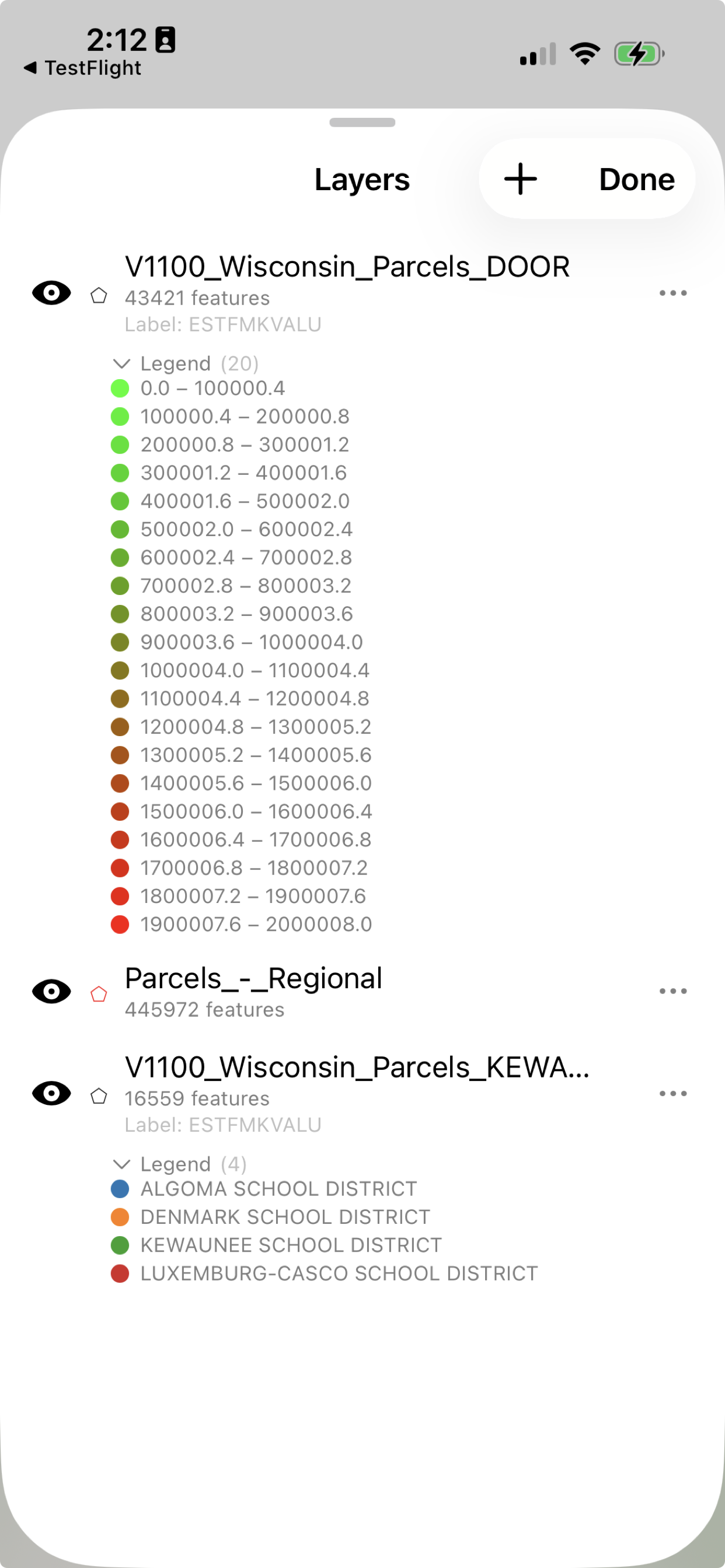
💪
Handles Large Layers
Load county parcels, infrastructure, survey, and environmental layers with hundreds of thousands of features. Keep the field map useful even when the data is not small.
🗺
Work Privately On-Device
Your project lives on your device. Collect data, review attributes, use cached maps, and sync with nearby devices without creating an account or uploading your field project to a required cloud.
🎨
Color-Code Your Data
See patterns at a glance. Color parcels by zone, pipes by material, fields by crop type — automatic color coding from your data with a few taps.
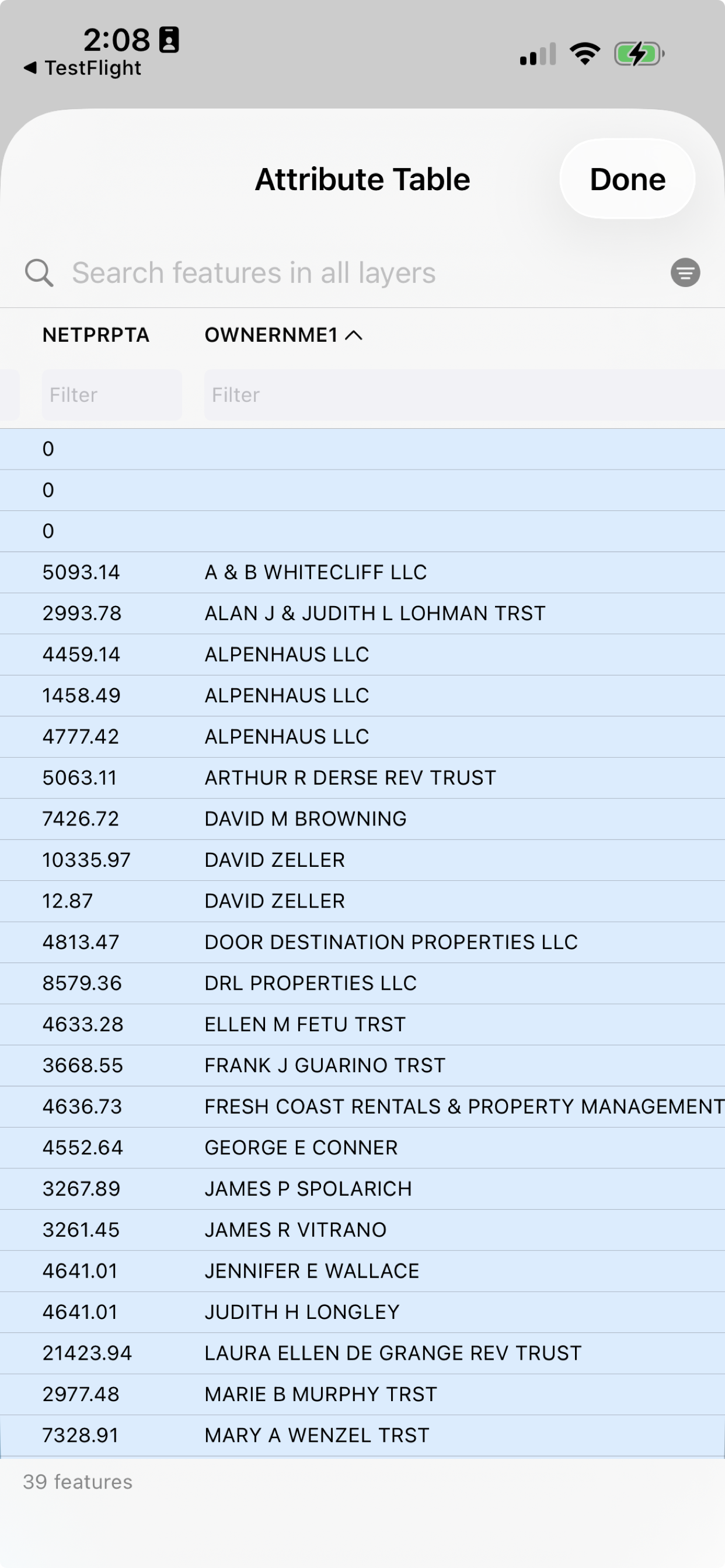
📊
Search & Filter Your Data
Find what you need fast. Search across all your data, filter by any attribute, tap a row to jump straight to it on the map.
📴
Works Without Internet
Everything works offline. Load your data, explore your maps, collect points — no cell signal required. Basemap tiles are cached automatically.
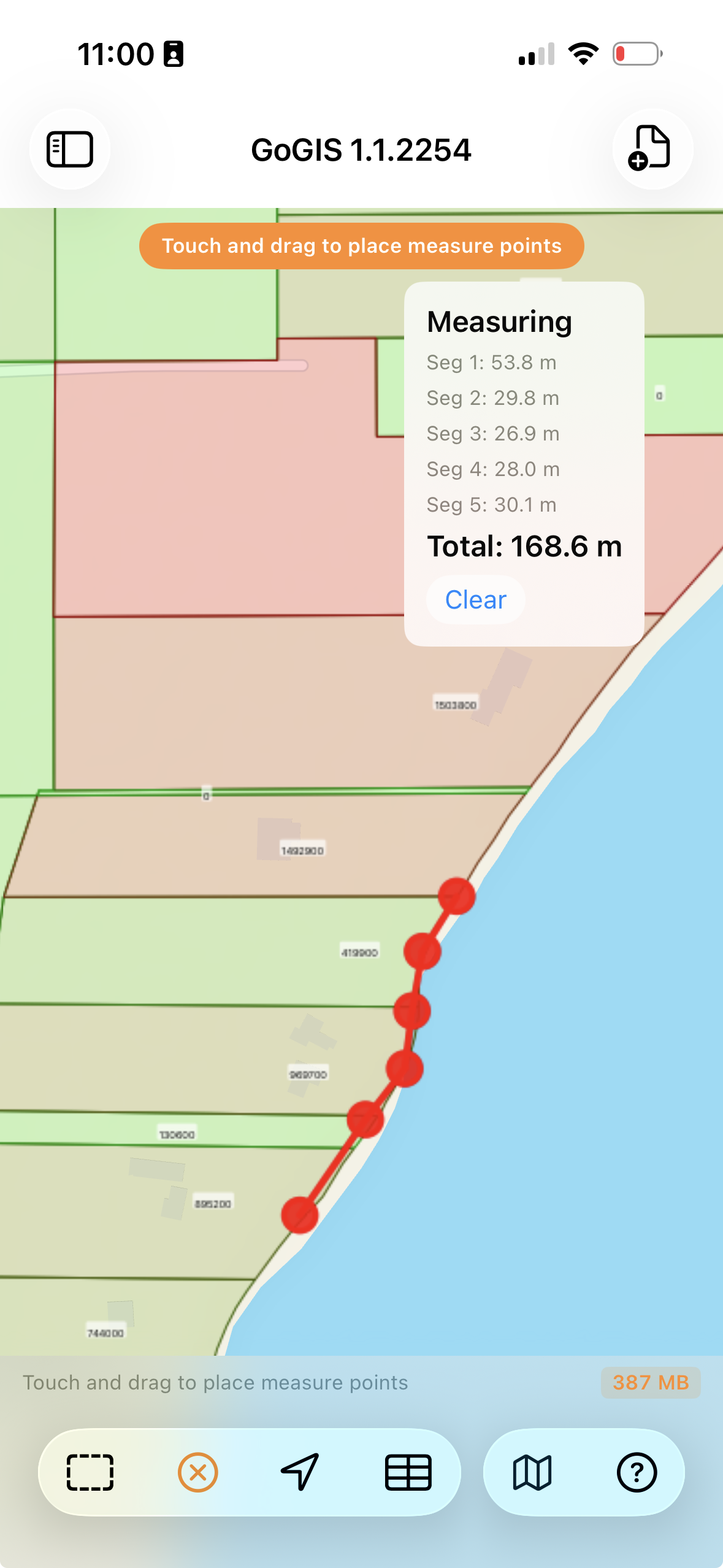
📏
Measure on the Map
Tap to measure distances between points. See segment lengths and totals in feet, miles, meters, or kilometers.
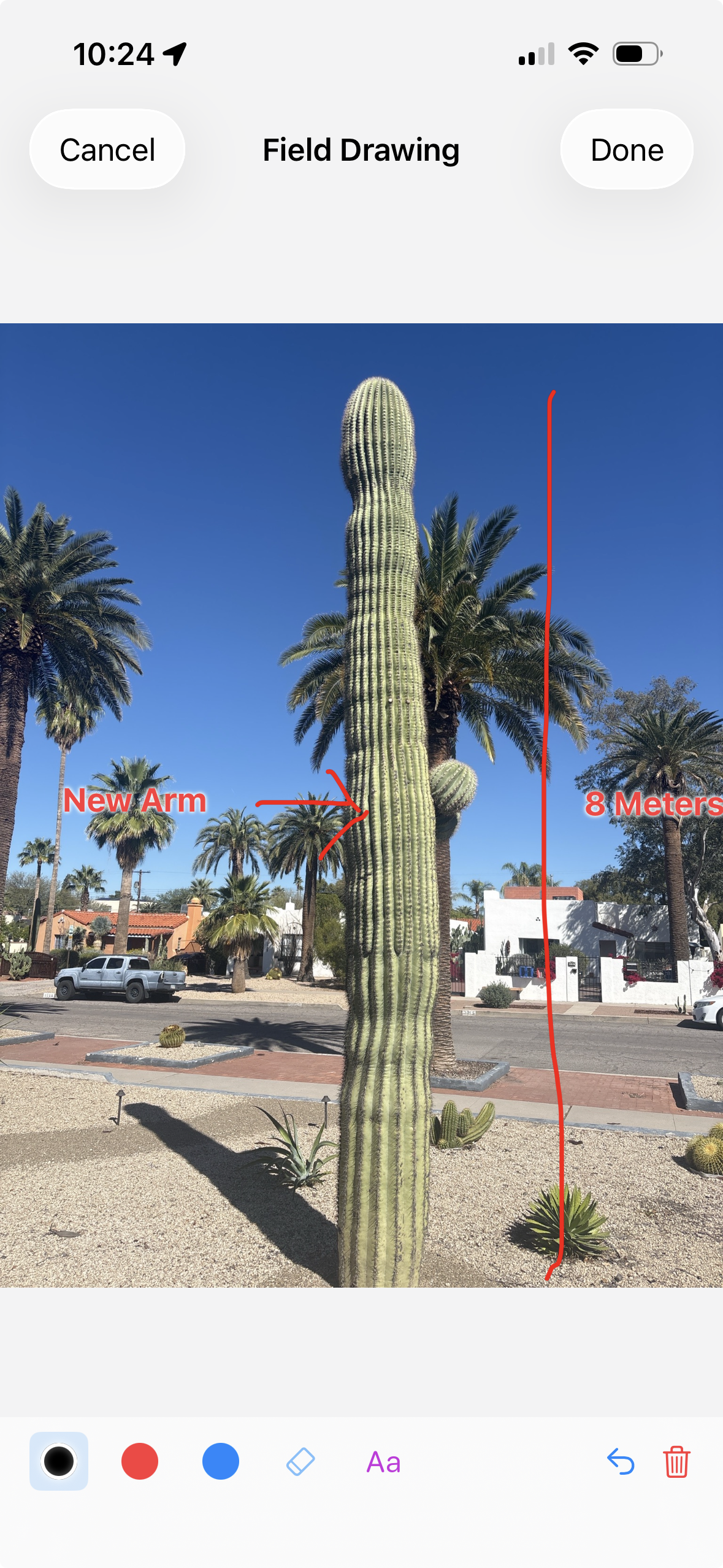
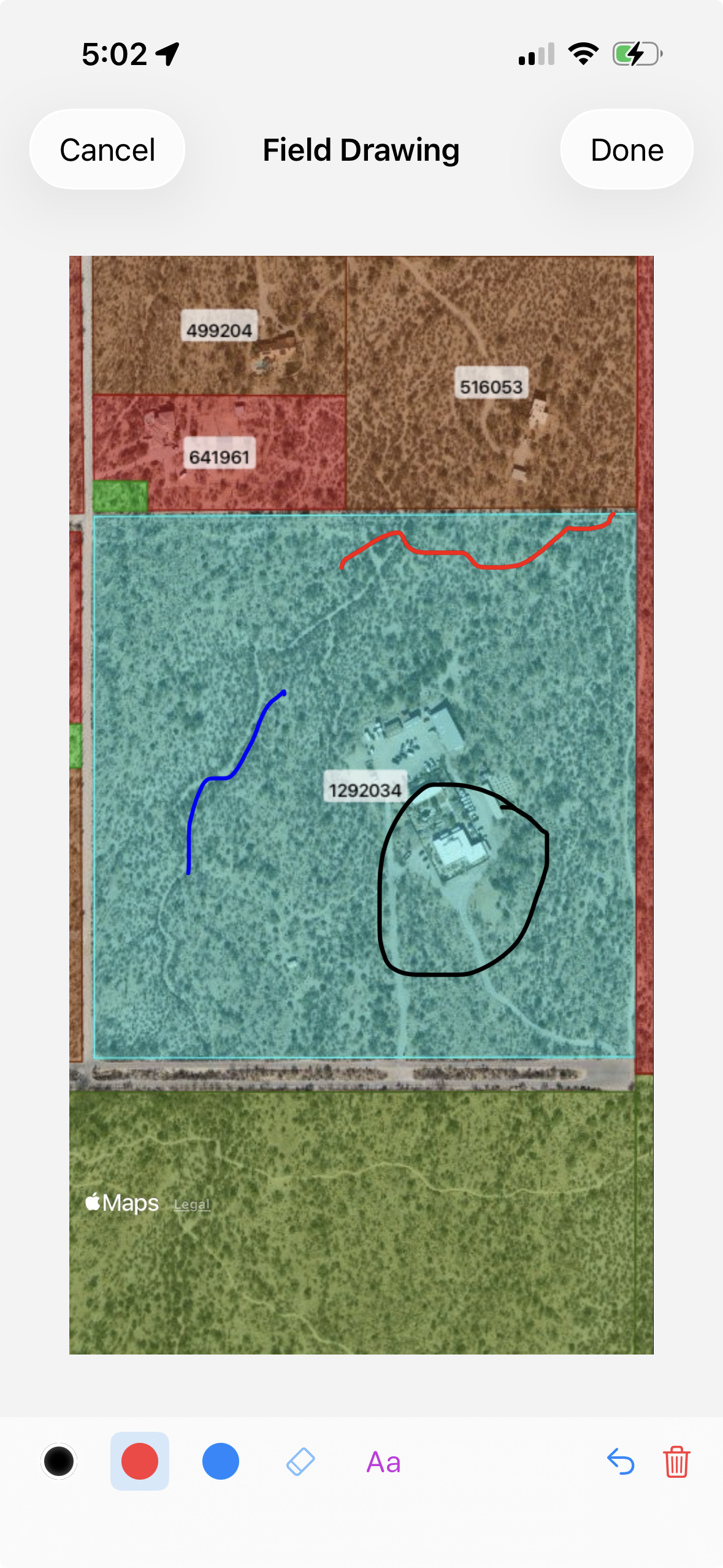
📷
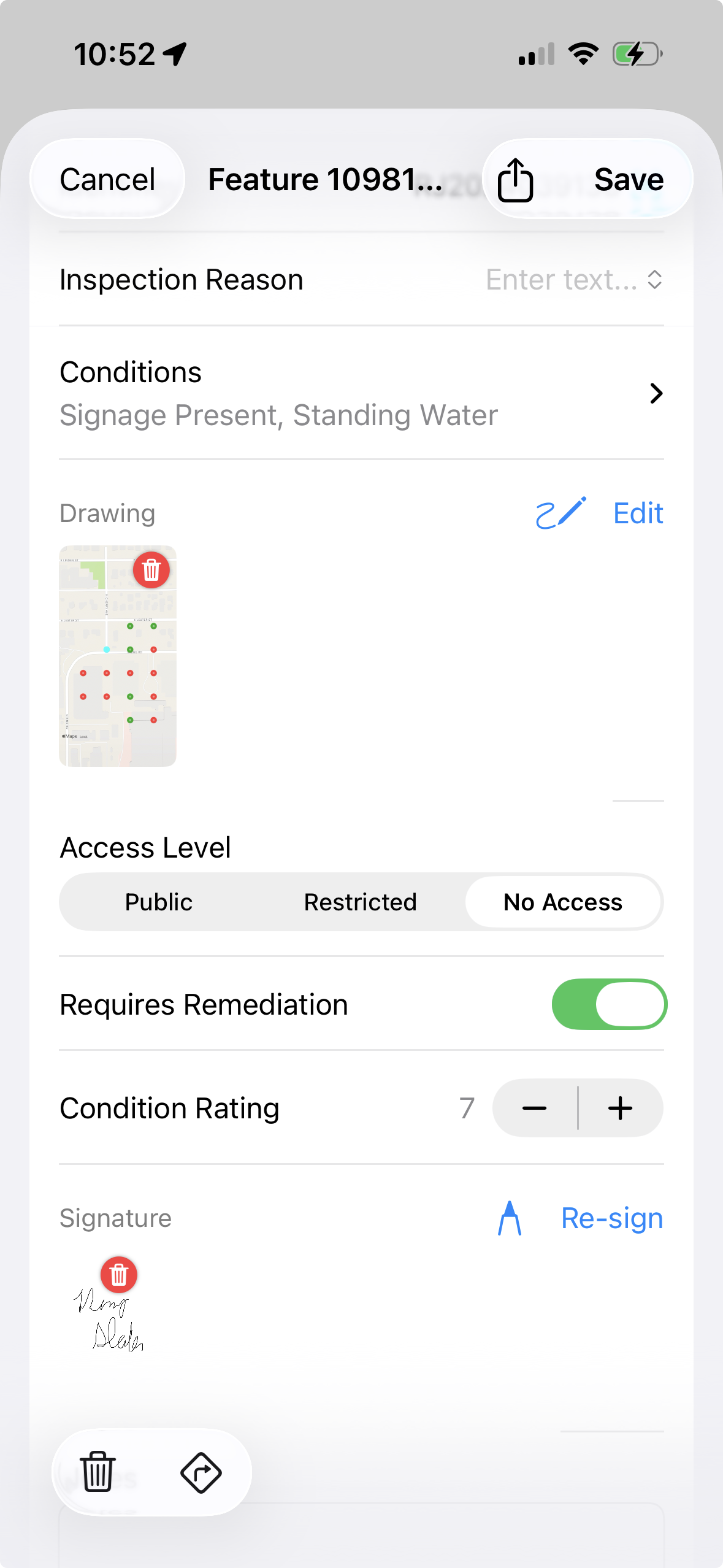
Collect Data & Photos
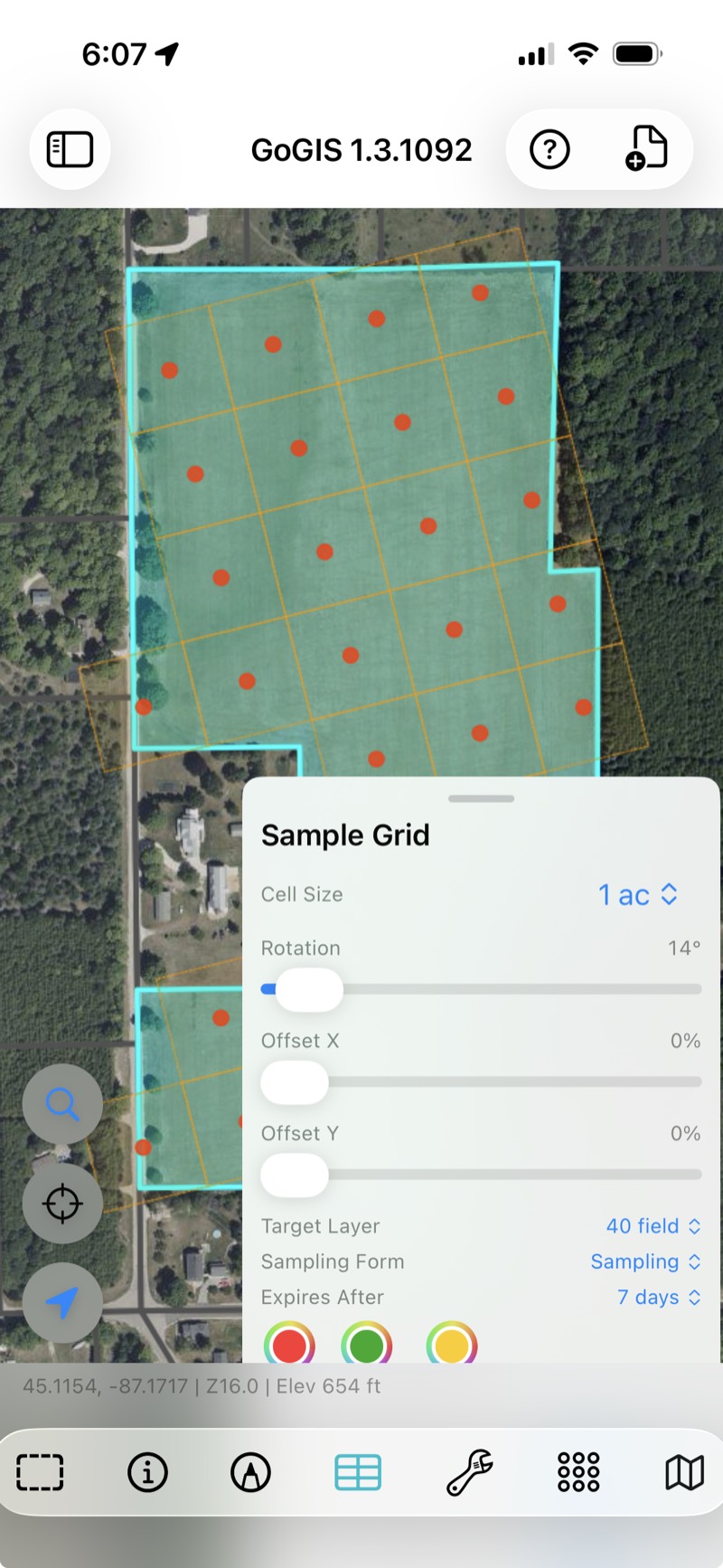
Mark locations, snap photos, scan barcodes, and fill smart forms on-site. Use pick lists, formulas, and conditional fields to collect cleaner attributes with less typing.
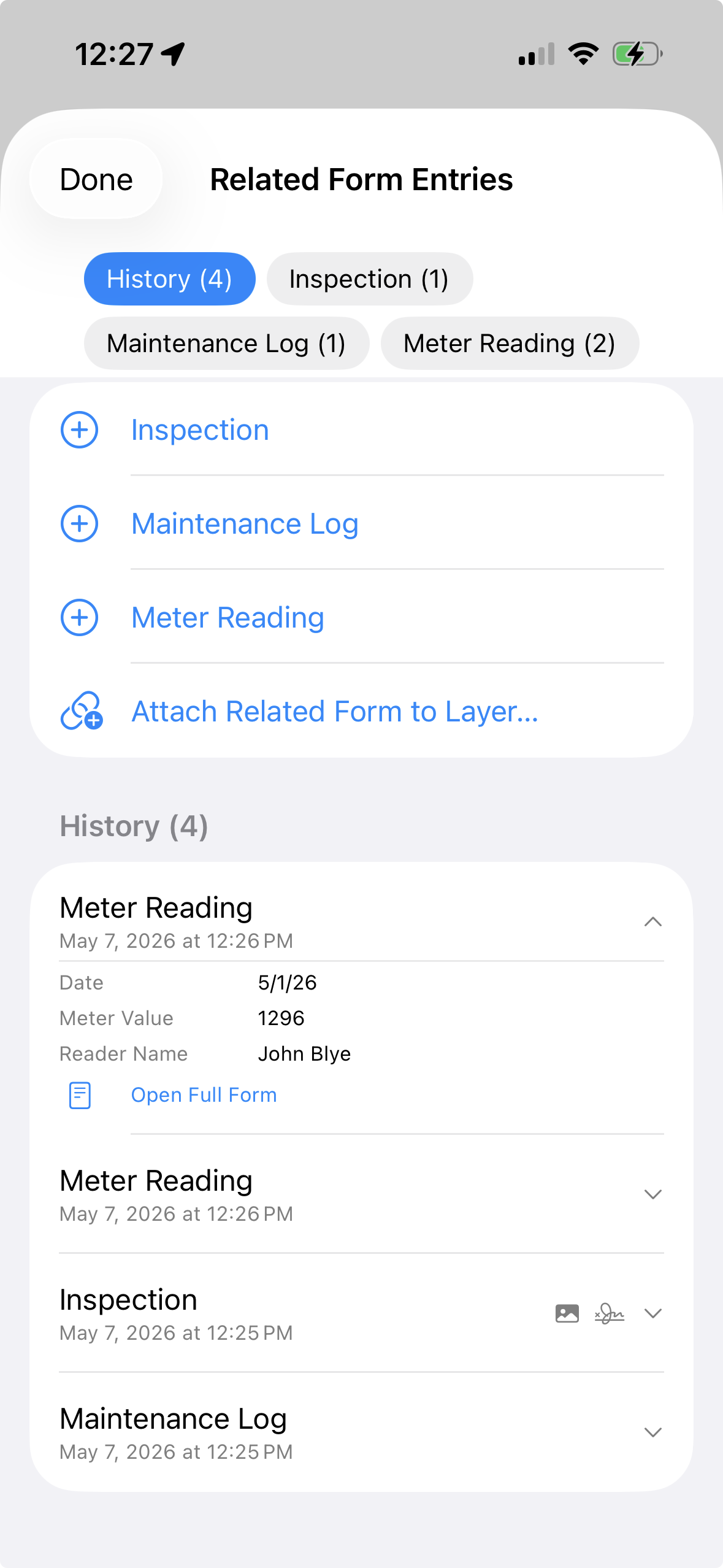
🔗
Related Forms for Repeat Work
Attach Inspection, Maintenance Log, and Meter Reading forms to the same asset layer. Fill them out again and again while keeping every record linked to the parent feature.
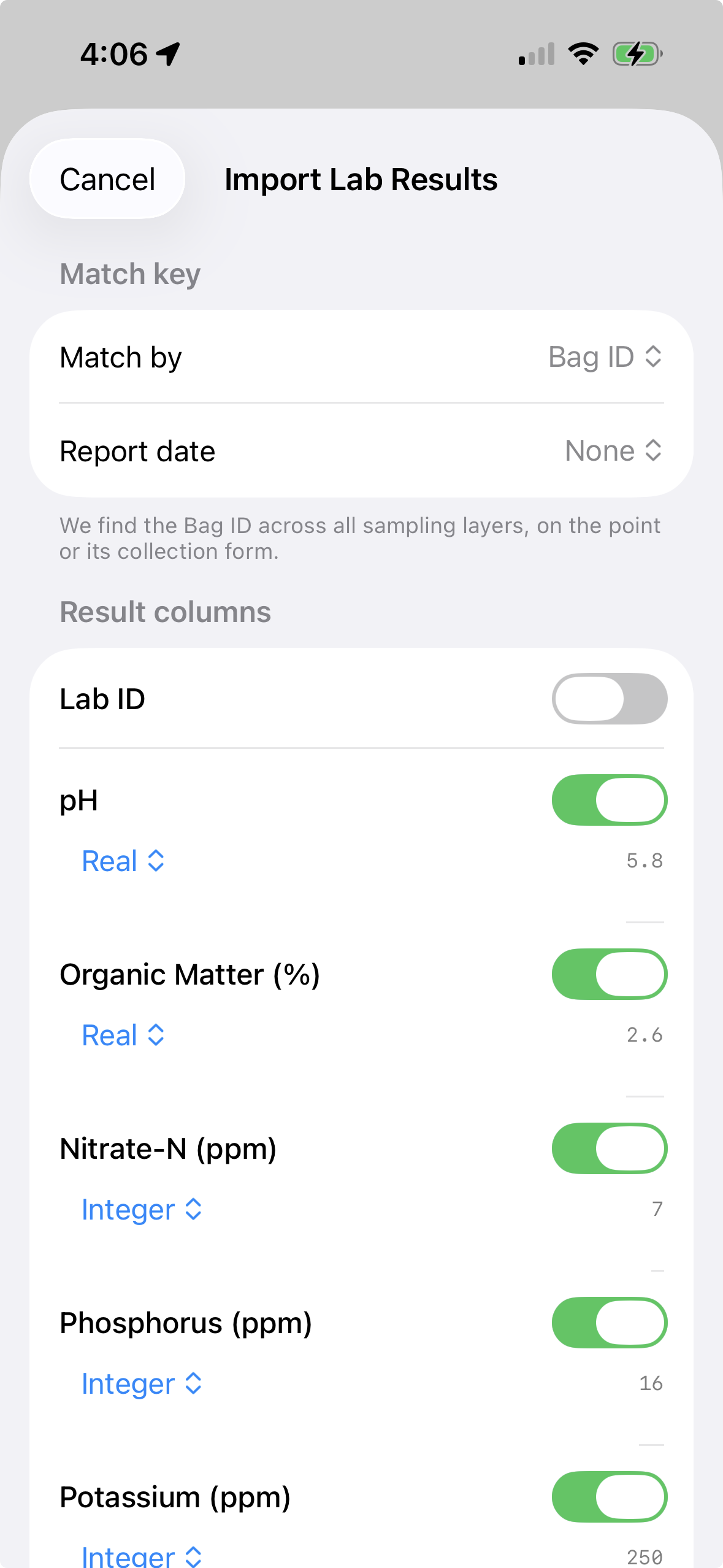
📥
Import & Export CSV
Import CSV spreadsheets with coordinates to create point layers. Export any layer as GeoJSON, KML, Shapefile, or CSV — with photos bundled in a ZIP.
🌍
Core Website Languages
Website available in English, Spanish, French, German, Portuguese, Japanese, Korean, Arabic, Italian, and Turkish.
📍
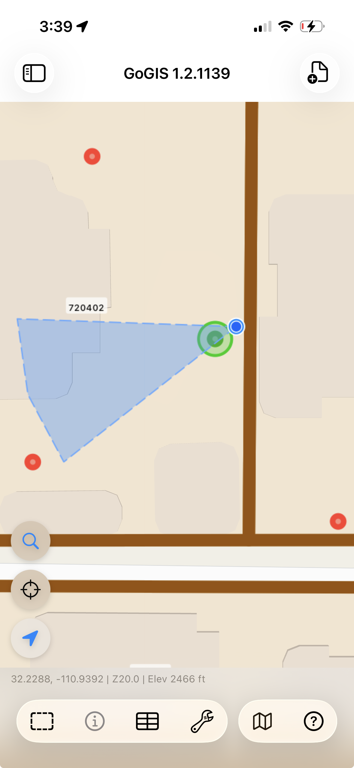
Collect Points in the Field
Tap the map to drop GPS-stamped points. Fill out attribute forms, snap photos, and scan barcodes — all on-site. Every observation is saved to your layer instantly.
🛰
Download Reference Data
Pull in SSURGO soils, FEMA flood zones, rivers, and wetlands directly from the map. No external downloads or file hunting required.
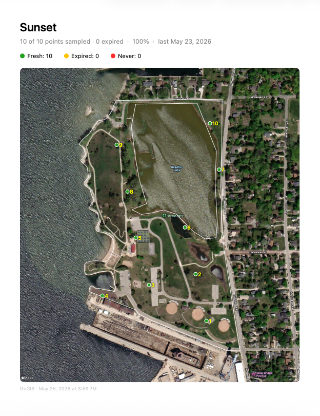
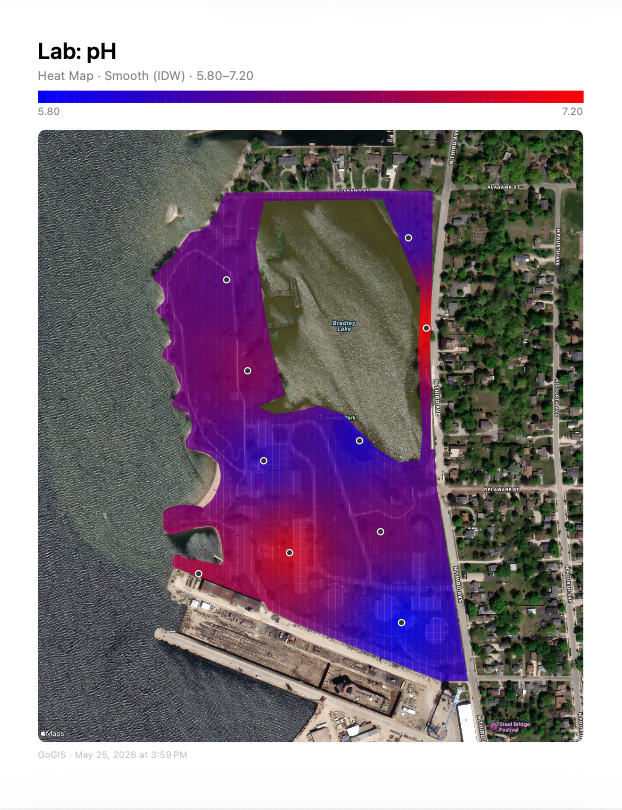
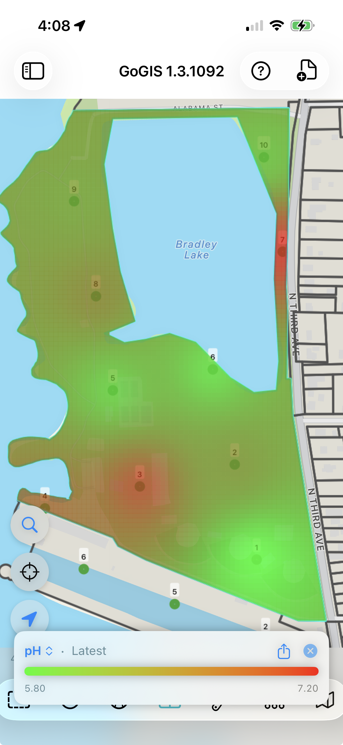 Heat Maps from Points
 Related Forms
 Import & Export
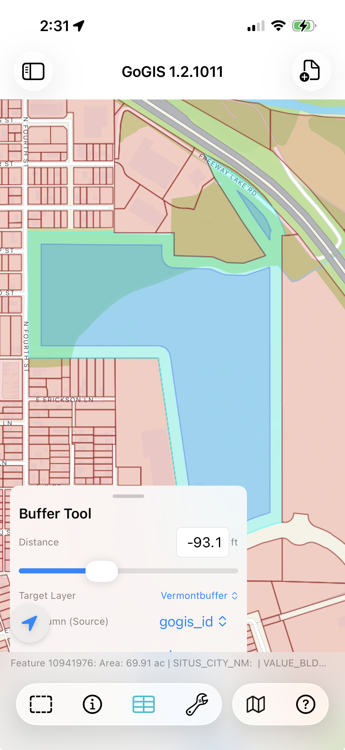
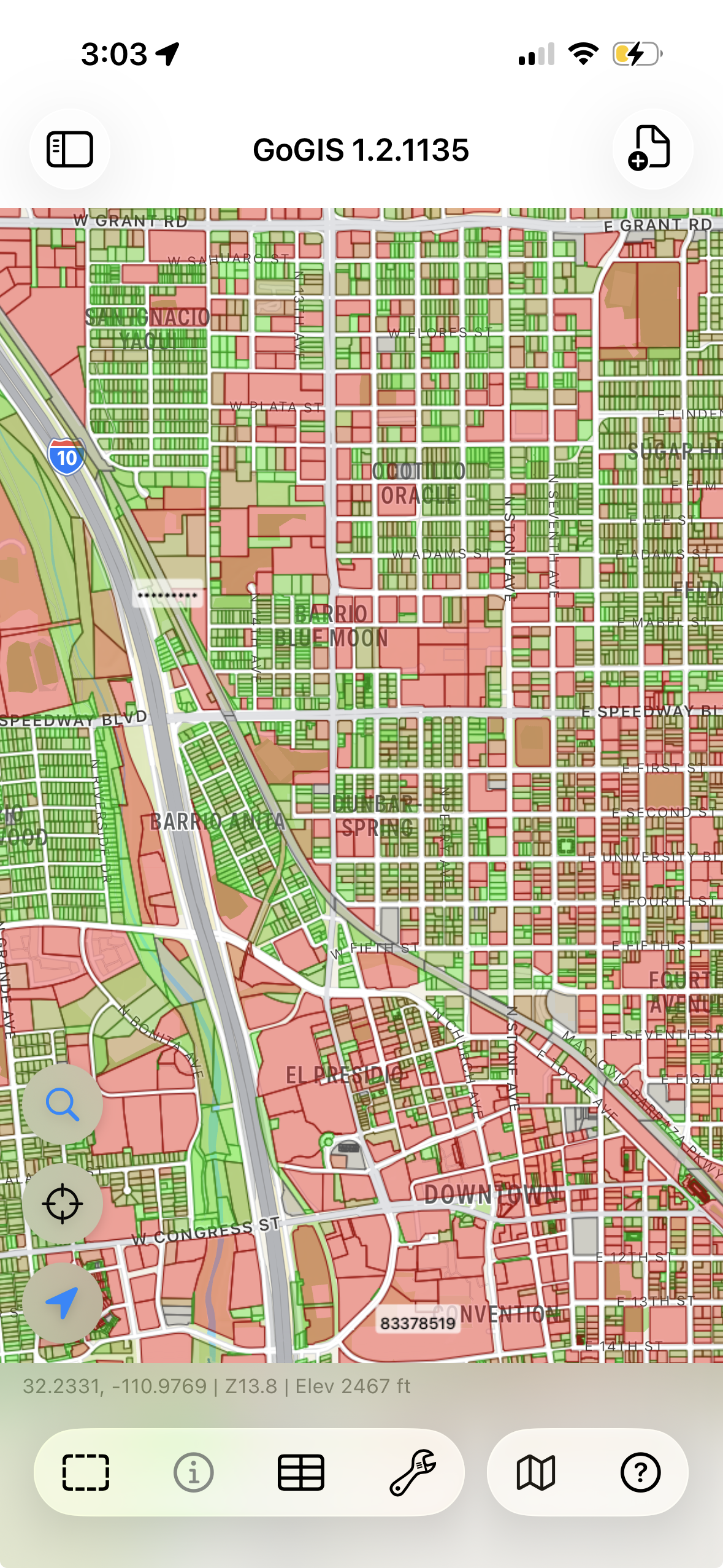 Large GIS Layers
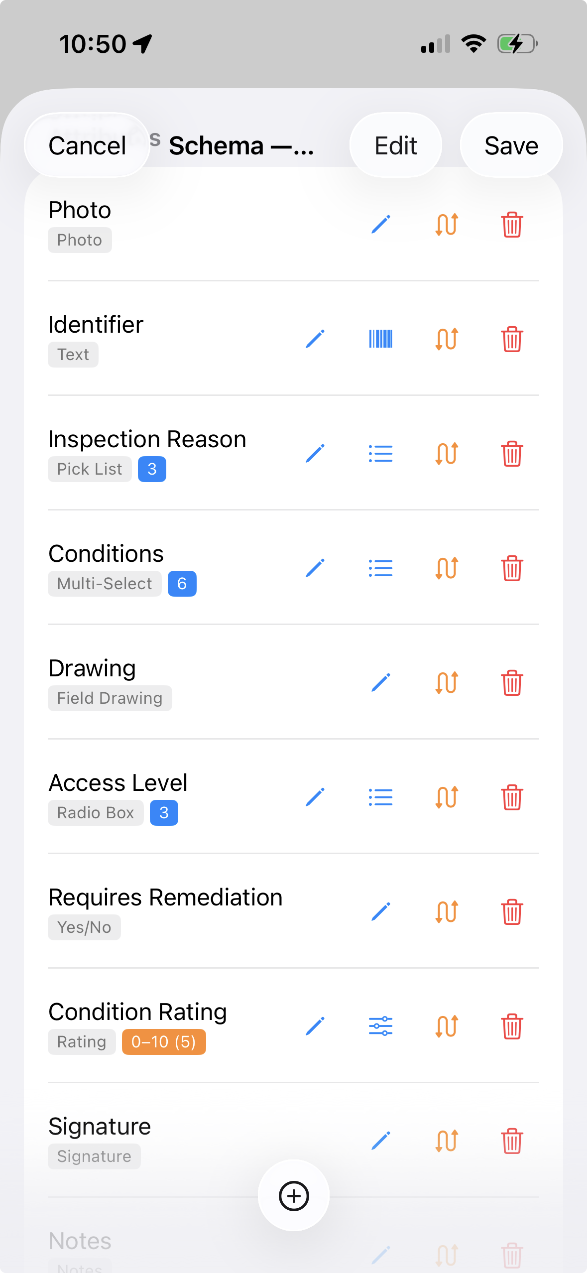 Custom Forms