Custom Data Collection Forms for Mobile GIS
A field form should make the required observations clear and keep records consistent. Pick lists standardize recurring values, date fields record visits and follow-ups, and photos document what the inspector found.
GoGIS lets you build forms for mapped features and repeat visits. Use calculated fields to derive values from other records, and conditional fields in Related Forms to show questions when they apply. Each entry stays linked to its map feature.
What You Can Put in a Form
GoGIS supports several field types that cover the range of what field crews typically need to record:
Pick Lists (Drop-Down Selection)
Define the choices for a field, such as material, condition, land use, or species. Selecting from a list reduces spelling variations and makes records easier to filter and compare.
For example, a material list containing PVC, Concrete, and Steel gives inspectors a consistent vocabulary while leaving a separate notes field for additional observations.
Multi-Select Pick Lists
When a feature can have more than one value — multiple damage types on the same structure, several species observed at a plot, or a combination of land uses — use a multi-select pick list. The user taps all the options that apply, and the selections are stored together in the attribute field. Same data quality benefit as a single-select pick list, but without forcing a single answer when the reality is more complex.
Date & Time Picker
Use date and time fields for inspection dates, scheduled follow-ups, or permit dates. A picker avoids typing dates manually. Keep the date of the field visit separate from the timestamp showing when the entry was created.
Text Fields
Free-text entry for notes, descriptions, addresses, or any value that can't be predicted in advance. Use these sparingly for things that genuinely need free input — the more you can constrain with pick lists, the cleaner your data.
Barcode & QR Code Scanning
Tap the scan button on any text field and point your camera at a barcode or QR code. The decoded value populates the field automatically. Use this for sample bag IDs, asset tags, equipment serial numbers, or any pre-printed label.
Radio Buttons
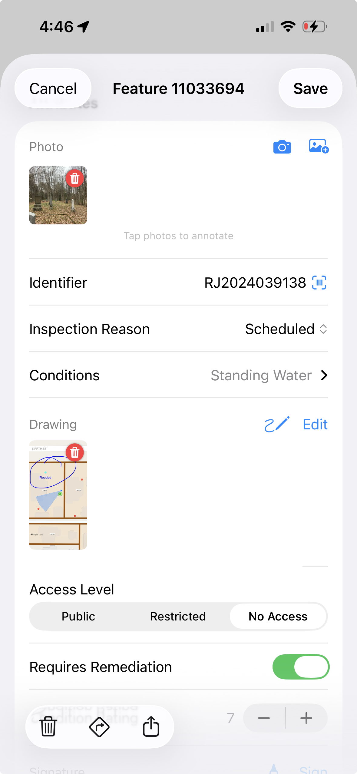
When a pick list has just a handful of options and you want them all visible at once, use a radio button field. Instead of tapping to open a drop-down, all choices are right there on the form — tap one and move on. Ideal for condition ratings (Good / Fair / Poor), status fields (Open / Closed / Pending), or any short list where speed matters.
Yes / No Toggle
A simple binary switch for fields that only have two states: present or absent, accessible or blocked, compliant or non-compliant. One tap, no ambiguity. Use these for inspection checklists, permit compliance, safety checks — anywhere a yes/no answer is all you need.
Rating Scale
A visual star or numeric rating input for subjective assessments. Rate pavement condition from 1–5, give a site a cleanliness score, rank vegetation health. The rating is stored as a number in your attribute table, ready for analysis and comparison across sites.
Photo Capture
Attach photos to the feature or related entry they document. Include media with the export when sharing the observations, so the recipient can review images alongside the records.
Field Drawing
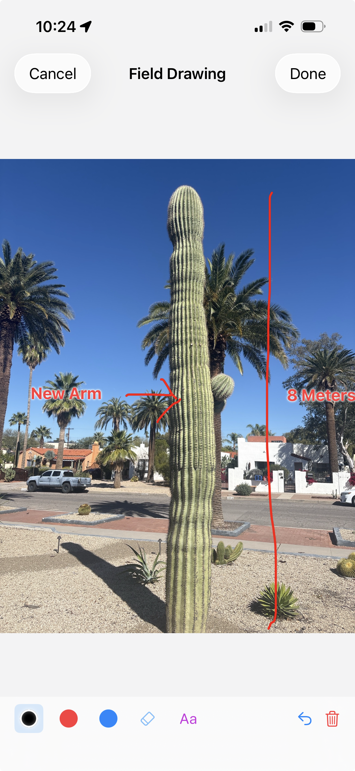
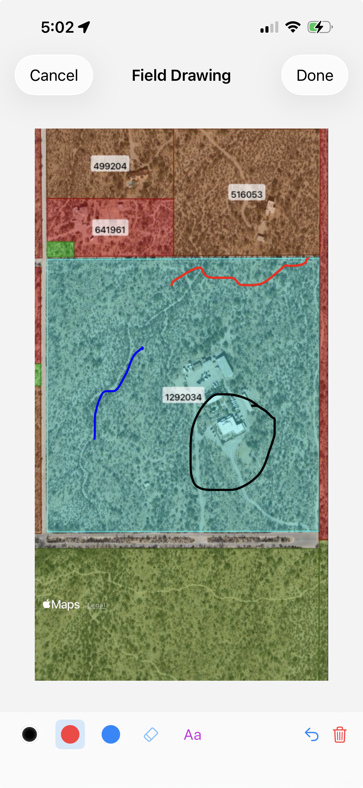
Sometimes a photo isn't enough — you need to sketch what you're seeing. The field drawing tool lets you draw directly on a photo or blank canvas: mark up damage locations, diagram a site layout, annotate a cross-section. The drawing saves as an image attached to the feature, just like a photo.
Signature Capture
For workflows that require sign-off — delivery confirmation, chain-of-custody documentation, inspection acknowledgment — add a signature field. The user signs on the screen with their finger, and the signature is saved as part of the record.
Computed Values and Formulas
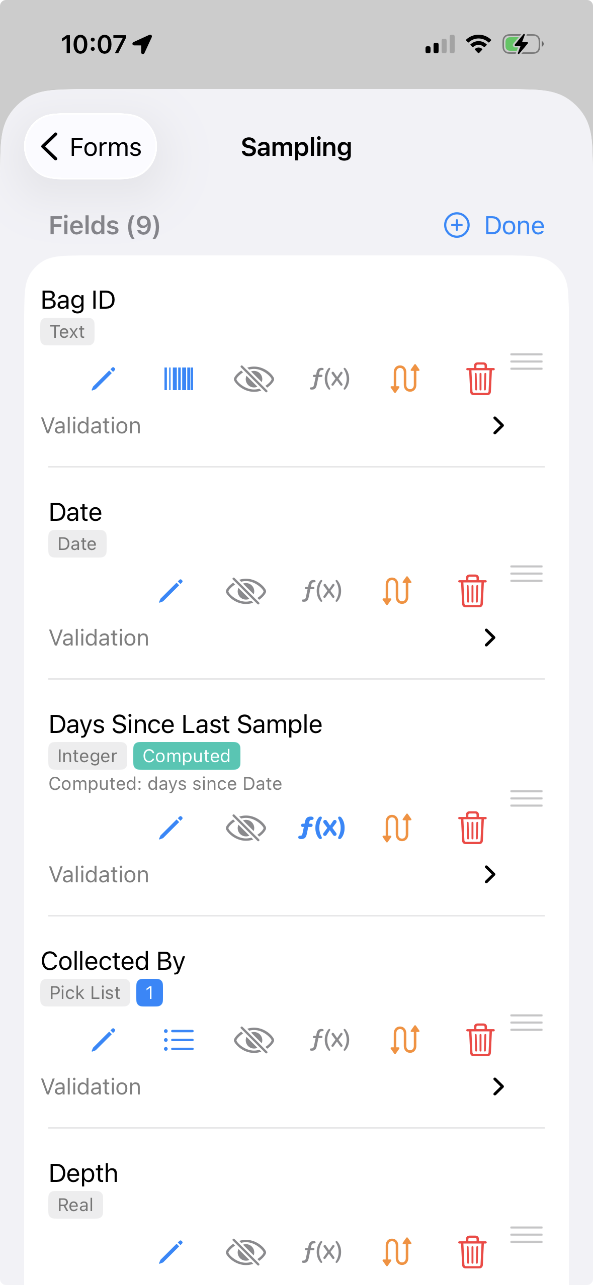
Some form values should not be typed by hand at all. GoGIS forms can include calculated fields that read values from the current form, the base feature attributes, or related forms attached to the same feature. That lets the form do the math while the person in the field focuses on observations.
Common formula uses include totals, rates, days since a previous visit, reference values from another form, and simple quality-control checks. Computed values are shown as read-only results so they are not accidentally overwritten during data entry.
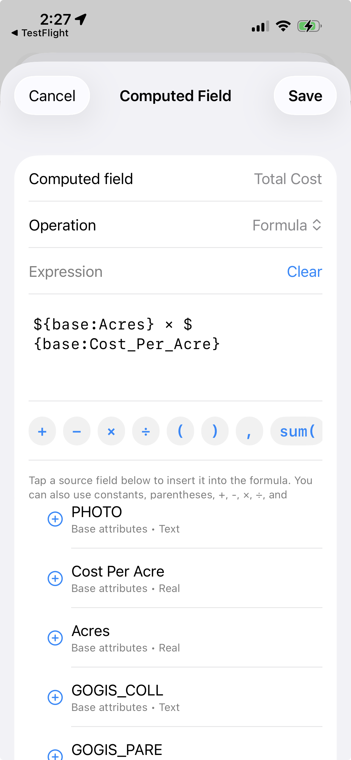
Example: Calculate Total Spray Cost
A spray record might include Acres and Cost per Acre. Instead of asking the user to multiply those numbers in the truck, add a calculated field such as:
Total Cost = Acres × Cost per Acre
The same pattern works for sample totals, quantities used, estimated costs, application rates, and any workflow where several field values combine into one result.
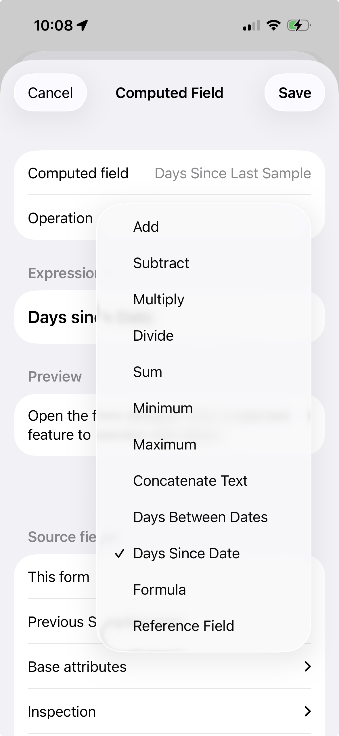
Example: Days Since Last Inspection
A form can compare a date field from a previous related record to the current date. For example, an inspection workflow might calculate how many days have elapsed since the last visit with a Days Since calculation:
Days Since Last Inspection = Days Since Previous Inspection Date
That value can be displayed directly, used in a report, or paired with Field Rules so the form only asks follow-up questions when enough time has passed.
Show or Hide Fields with Rules
Good field forms should not ask every possible question every time. Field Rules let a form stay short until a particular answer makes more fields relevant. Rules are available on Related Forms in Manage Related Forms.
How to set a rule in the app
- Open Manage Related Forms, then open the form and edit its fields.
- On the field that should appear only sometimes, tap the eye-slash icon to open Field Rules.
- Turn on Show only when condition is true, pick the source field (for example Status), choose an operator (equals, greater than, contains, and so on), and enter the value (for example Damaged).
- Optionally turn on Required when condition is true so follow-up fields become required only when they are relevant.
- Save. When someone fills the form, fields appear, hide, and change required state live as answers change.
Each rule uses one condition on one source field. Add the source field on the form first. Do not use the f(x) button for visibility — f(x) is only for calculated values.
Example: Hide a Follow-Up Section Until Enough Days Have Passed
Suppose a site only needs a follow-up inspection every 30 days. The form can calculate Days Since Last Inspection with f(x), then use Field Rules to hide follow-up questions until that value is 30 or greater. The crew still sees the status, but they do not have to work through questions that are not due yet.
Example: Branch from a Pick List
Pick lists are also useful for driving the rest of the form. If Issue Type is set to Leak, Field Rules can show fields for flow, wet area, and repair priority. If the user chooses Vegetation, other rules can show species, height, and treatment fields. The result is one flexible form that still feels simple on a phone.
Edit One Record or Update Several Together
Fieldwork includes revising existing data as well as collecting new observations. GoGIS gives you three ways to make those changes:
- Open a feature’s form. Tap the feature on the map to review its attributes, change values, or add photographs and notes.
- Edit a cell in the Attribute Grid. Open the grid from the layer menu and tap an editable cell to change its value without opening the full form.
- Update several selected records. Enter selection mode, check the rows you want to change, choose a column, and apply one value to those records together.
For example, correct one culvert’s pipe diameter directly in the grid. To assign the same inspection priority to several culverts, select their rows and apply the priority once. The change applies to the selected records, so other culverts retain their existing values.
Entering selection mode does not automatically check every row. Use the checkboxes to choose records, or Select All when available. Large tables using paged access may restrict bulk selection. After an edit, the brief Undo action lets you reverse the last change.
Example: A Culvert Inspection
Keep the Culvert ID, pipe diameter, and location on the main feature. Add a related Culvert Inspection form for each visit, with Inspection Date, Inspector, Overall Condition, Inlet Obstruction (%), Outlet Condition, Maintenance Required, Site Photos, and Observations.
When Maintenance Required is Yes, use Field Rules to show Recommended Action and Follow-up Date. A later inspection becomes another entry against the same culvert, preserving the earlier observations. See the related forms guide for reviewing repeat visits.
Export Your Data
Export the feature layer as Shapefile, GeoJSON, CSV, or KML, choosing a format supported by the receiving software. Related entries export as linked CSV records, with media included in the export package where selected. The export linking guide explains how to reconnect the records to their features.
Build a form for your fieldwork
GoGIS is a one-time purchase for iPhone and iPad. No subscription, no account required.
Get GoGIS on the App Store