Loading Large Shapefiles & Spatial Datasets on Your Phone
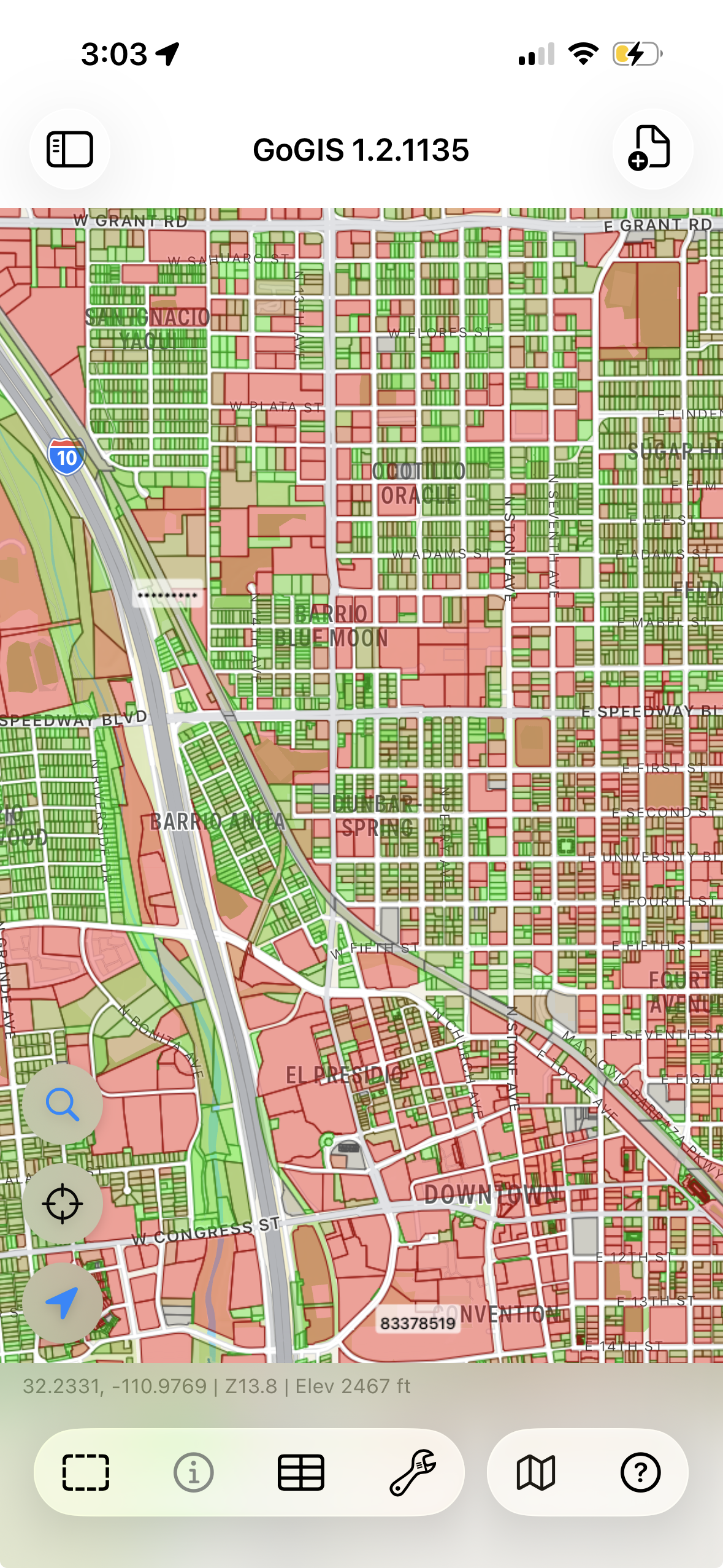
A county parcel layer can contain hundreds of thousands of features. Working with it on a phone requires attention to file size, geometry complexity, and the amount of data displayed at once.
GoGIS imports spatial data into a local database so you can browse the map and query attributes without loading every feature into a single view.
How GoGIS Handles Big Data
When you load a file in GoGIS, it doesn't dump the entire dataset into memory. Instead, it imports the data into an indexed spatial database on your device. This means:
- Map extent controls the view — zoom to the area you want to inspect. Rendering limits keep the map manageable; the features drawn at a particular zoom level are not an inventory of every record in the layer.
- Spatial indexing narrows map queries — the database can find features in an area without checking every geometry individually. Response time still depends on the data and device.
- Records are loaded as needed — database-backed access reduces the need to hold an entire layer in memory. Available memory, storage, and geometry complexity still affect practical limits.
What "Large" Actually Means
Examples of useful large-layer workflows include:
- County parcels — browse boundaries, inspect attributes, and color-code records by an available field.
- Regional datasets — organize the layers needed for your work area and test a representative file on the device you will use before preparing a large field project.
- Road centerlines — statewide road networks with 100,000+ line segments.
- Infrastructure inventories — utility poles, manholes, fire hydrants, signs — point layers with tens of thousands of features and attached photos.
- Environmental boundaries — wetland polygons, soil units, land cover classifications covering large geographic areas.
Plan for the imported project as well as the source file. Leave space for the download, extraction, database, and any media you collect. Feature count alone does not predict performance: complex polygons and wide attribute tables can require more resources than simpler records.
Supported Formats
Big datasets come in various formats depending on the source. GoGIS handles all the common ones:
- Shapefile (.shp in .zip) — the most common format for government open data portals. Drop the ZIP file into GoGIS and it extracts and imports automatically.
- GeoPackage (.gpkg) — the modern replacement for shapefiles. Supports multiple layers in a single file, which is useful for large datasets that include related tables.
- GeoJSON (.geojson) — useful for exchanging geometry and attributes. Import time depends on file size and complexity.
- KML/KMZ (.kml, .kmz) — useful for Google Earth data. Check the imported geometry, attributes, and styling before using the project in the field.
- CSV (.csv) — for point data with lat/lon columns. GoGIS reads the coordinates and plots them on the map.
Tips for Working with Large Datasets
Use Color Coding
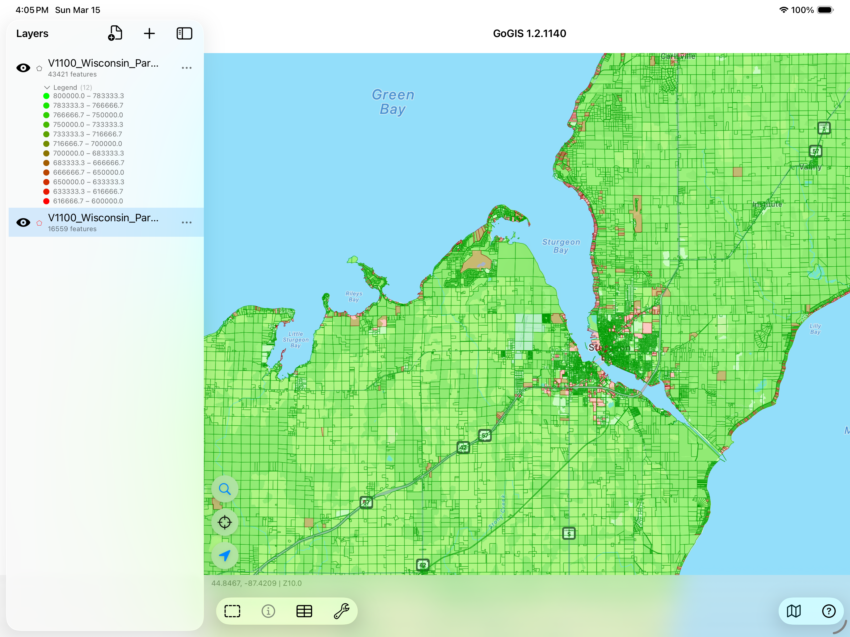
When you have thousands of features on screen, they all look the same. Color-code by an attribute — zone type, land use, owner, status — and patterns jump out instantly. This is often the whole reason someone loads a large dataset: to see the spatial pattern.
Search and Filter
Open the layer menu and choose the Attribute Grid to review records. Search and filter by values such as owner, date, or land-use code. Large tables can use paged access; bulk actions such as Select All may be unavailable in that mode. Narrow the records to the work you need to perform.
Layer Multiple Datasets
The real power of a mobile GIS isn't just opening one big file — it's stacking layers. Put the parcel data on the bottom, add flood zones, overlay your field observations on top. Toggle layers on and off to see relationships that aren't obvious in any single dataset.
Getting Large Files onto Your Device
The files have to get to your phone somehow. A few options:
- iCloud Drive or Google Drive — upload the file from your desktop, open it from the Files app on your device
- AirDrop — if you're on a Mac, AirDrop large files directly to your iPhone or iPad
- Email — works for smaller files, but most email providers cap attachments at 25 MB
- Direct download — many county and state GIS portals offer direct shapefile downloads. Open the link in Safari on your device and GoGIS can open the downloaded file
Bring your working datasets into the field
Browse maps, inspect attributes, and collect observations in one project. GoGIS is a one-time purchase with no subscription.
Get GoGIS on the App Store